Ski tour · Winter
Östliche Knotenspitze 3082 m
- Duration
- 3 h 30 min
- Distance
- 4.5 km
- Ascent
- 970 mDescent 30 m
- Highest point
- 3080 mfrom 2150 m
- Difficulty
- Mountaineering ZS · Ski ZSSAC alpine scale (Abzweigung Gschwezgrat – Östliche Knotenspitze) · SAC ski touring scale (Abzweigung Gschwezgrat – Östliche Knotenspitze)
- Start / finish
- Franz-Senn-HütteFinish: Östliche Knotenspitze
Equipment: Glacier equipment
Route points: Franz-Senn-Hütte 0,0 km, 2150 m – Abzweigung Gschwezgrat 1,4 km, 2400 m – Östliche Knotenspitze 4,3 km, 3080 m
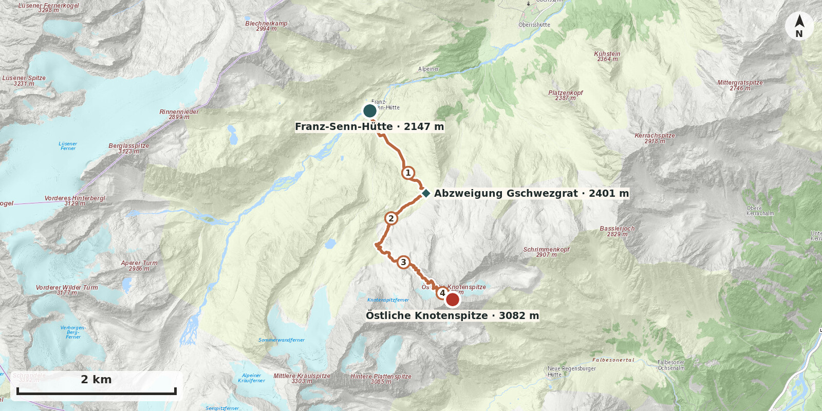
Östliche Knotenspitze (3082 m) stands within sight of the Franz-Senn-Hütte and, with a little over 900 metres of ascent, is an ideal objective for a shorter day. It is not harmless for that reason: the ascent leads over the Knotenspitzferner and ends in a very steep, narrow summit gully followed by a blocky ridge. A high-level ski tour for experienced ski mountaineers with secure crampon technique.
Route description
-
Franz-Senn-Hütte → Abzweigung Gschwezgrat
From the hut, first follow the valley floor on level ground, then climb a short steep step and continue over easier ground southwards below the Gschwezgrat at about 2400 m.
-
Abzweigung Gschwezgrat → Östliche Knotenspitze
Follow the level floor to its end. To the right of the prominent rock buttress, head south up a short, very steep north-facing slope into the cirque below the Alpeiner Knotenspitze and the Falbesoner Knotenspitze. Keep left below the rock spur running north down from the Falbesoner Knotenspitze. Pass it to reach the remnants of the Östliche Knotenspitzferner. Ascend the steepening glacier remnant on the true right to the foot of the summit gully – ski depot here at around 3000 m. Climb the narrow gully, 35–40° steep, to the west-south-west ridge (small saddle). Follow the boulder ridge, with around 50 metres of easy, partly exposed climbing, to the summit cross of Kreuzspitze, the immediate neighbouring summit of the Östliche Knotenspitze.