Access · Summer
Approach from Seduck
- Duration
- 3 h
- Distance
- 7.5 km
- Ascent
- 710 mDescent 10 m
- Highest point
- 2150 mfrom 1450 m
- Difficulty
- Trail Red mountain trail · Ski LTyrolean trail classification (Oberisshütte – Franz-Senn-Hütte) · SAC ski touring scale (Parkplatz Seduck – Oberisshütte)
- Start / finish
- Parkplatz SeduckFinish: Franz-Senn-Hütte
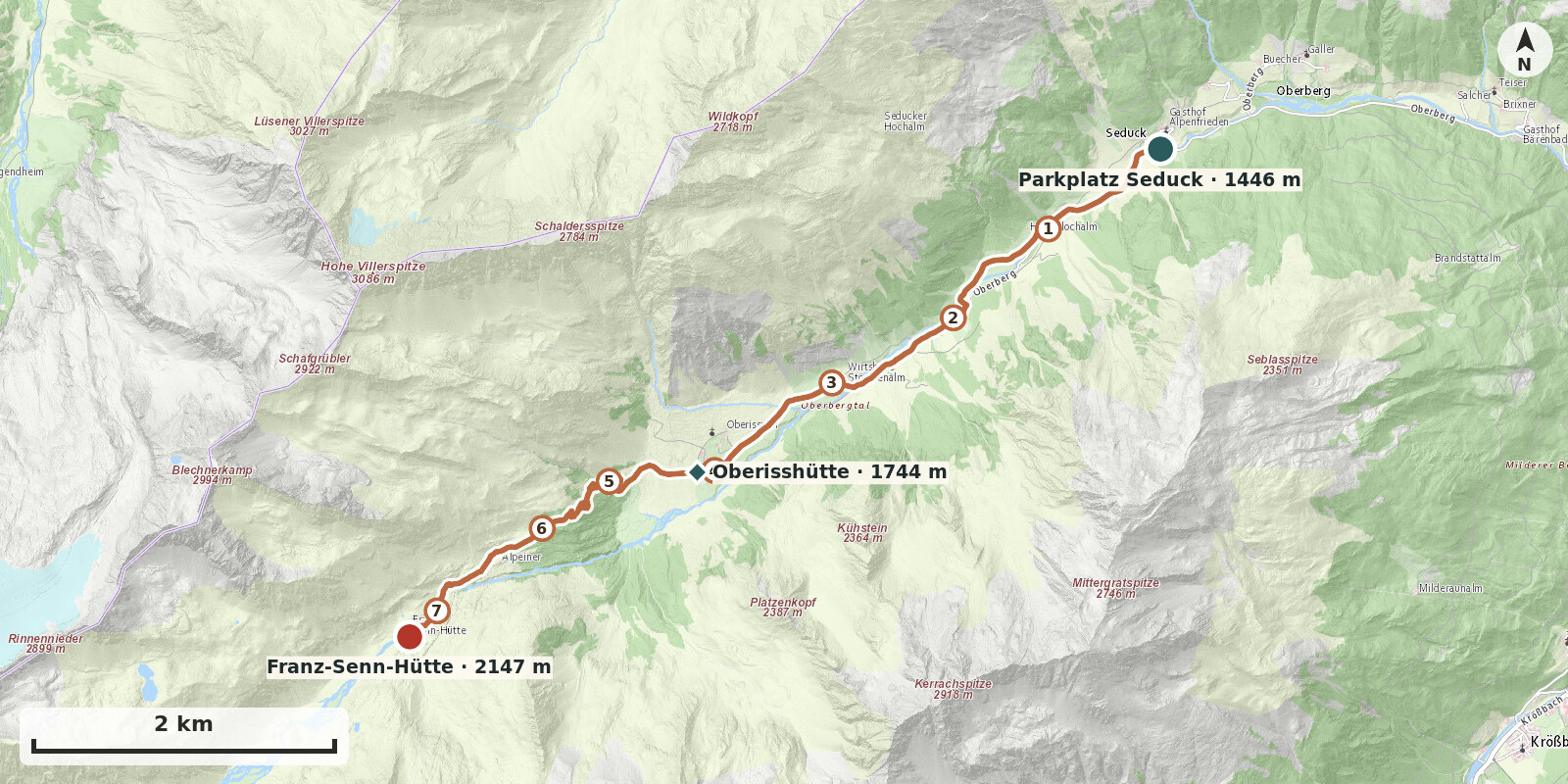
Route points: Parkplatz Seduck 0,0 km, 1450 m – Oberisshütte 4,1 km, 1740 m – Franz-Senn-Hütte 7,3 km, 2150 m
The road between Seduck and Oberiß is currently closed to public traffic. This is therefore currently the quickest approach.
Route description
-
Parkplatz Seduck → Oberisshütte
From the car park in Seduck, follow the path along the closed vehicle track on the left (facing uphill) of the stream to the bridge by the Holderloch Alm. Cross the stream there and continue past the small fish pond along the gravel track to the next bridge. Then cross back to the left side (facing uphill) and follow the path for about 1 km to the Stöcklenalm (bridge). From the Stöcklenalm it is another approx. 1 km to the Oberisshütte.
-
Oberisshütte → Franz-Senn-Hütte
From the Oberisshütte (1741 m), follow the yellow signposts towards the Franz-Senn-Hütte (path no. 131). Start almost level on the broad gravel track through the alpine meadows to the right side of the valley (facing uphill) as far as a cattle gate. Shortly afterwards the summer path and winter path separate: at the signpost the summer path branches off to the right and climbs the steep valley step in numerous switchbacks. After about one hour the steep section is over, and the hut comes into view for the first time. The path runs level across a plateau past the Alpeiner Alm (unstaffed). From here, climb gently up-valley beside the Alpeiner Bach, finally crossing the bridge and ascending to the Franz-Senn-Hütte (2147 m).