Hike · Summer
to the Starkenburger Hütte
First or final stage of the Stubaier Höhenweg
- Duration
- 7 h
- Distance
- 15 km
- Ascent
- 860 mDescent 780 m
- Highest point
- 2560 mfrom 2150 m
- Difficulty
- Trail Black mountain trailÖAV mountain trails (Abzweigung Horntaler Joch – Starkenburger Hütte)
- Start / finish
- Franz-Senn-HütteFinish: Starkenburger Hütte
Route points: Franz-Senn-Hütte 0,0 km, 2150 m – Abzweigung Höhenweg 0,5 km, 2200 m – Abzweigung Horntaler Joch 1,1 km, 2250 m – Starkenburger Hütte 15,4 km, 2240 m
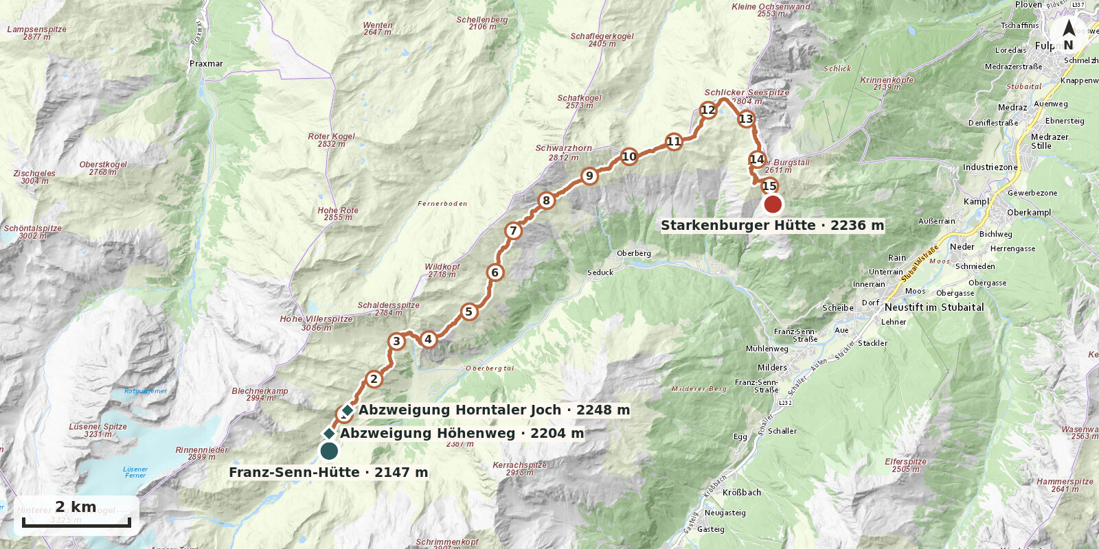
The crossing to the Starkenburger Hütte is the first or final stage of the Stubaier Höhenweg: a long high-level walk high above the Oberbergtal, with magnificent views of the Kalkkögel and the Stubaier Hauptkamm. A black-graded (difficult) mountain path with a few protected sections; above all, the length of around 15 km and 7 hours requires stamina.
Route description
-
Franz-Senn-Hütte → Abzweigung Höhenweg
Behind the hut, cross the bridge over the Alpeiner Bach and immediately turn right onto the marked path towards the Starkenburger Hütte. After about 10 minutes you reach the junction.
-
Abzweigung Höhenweg → Abzweigung Horntaler Joch
Immediately after the signpost, cross a small stream. The path first runs almost level along the sunny slopes down-valley, then climbs gently and gradually to the signpost at the turn-off for the Horntaler Joch – Starkenburger Hütte.
-
Abzweigung Horntaler Joch → Starkenburger Hütte
The path continues high above the floor of the Oberbergtal. Through the Villergrube (protected in places), you reach the Seducker Hochalm (serving refreshments) after about 2 h 30 min, and after a further 2 h 30 min the Sendersjöchl (steep final climb). Follow the crest throughout to the Seejöchl. Continue following the signs for the Starkenburger Hütte, passing the turn-off for the Schlickerscharte. After about 7 h you reach the stage destination, the Starkenburger Hütte.