Ski tour · Winter
Wildes Hinterbergl via the Berglasferner 3288 m
- Duration
- 4 h 30 min
- Distance
- 7 km
- Ascent
- 1160 mDescent 30 m
- Highest point
- 3290 mfrom 2150 m
- Difficulty
- Ski ZSSAC ski touring scale (Abzweigung Berglas Übergang – Wildes Hinterbergl)
- Start / finish
- Franz-Senn-HütteFinish: Wildes Hinterbergl
Equipment: Glacier equipment
Route points: Franz-Senn-Hütte 0,0 km, 2150 m – Abzweigung Berglasferner 2,5 km, 2270 m – Abzweigung Berglas Übergang 4,0 km, 2590 m – Wildes Hinterbergl 6,8 km, 3290 m
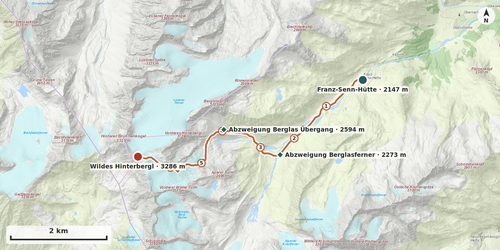
Wildes Hinterbergl is one of the most popular ski summits around the Franz-Senn-Hütte, and the route via the Berglasferner is the shortest way up. It is nevertheless not simply an easy outing: the Berglasferner is regarded as one of the most crevassed glaciers in the area and is only crossed roped up.
Route description
-
Franz-Senn-Hütte → Abzweigung Berglasferner
From the Franz-Senn-Hütte, follow the mostly groomed, pole-marked track to the head of the valley.
-
Abzweigung Berglasferner → Abzweigung Berglas Übergang
Shortly before the end of the prepared, pole-marked track, the route leads right over the moraine and up the sunny slopes into the Berglastal. Pass the Jägerhütte, cross another moraine towards the Berglasübergang, and follow the moraine valley to its end (2600 m).
-
Abzweigung Berglas Übergang → Wildes Hinterbergl
From the end of the moraine valley, climb south-westwards, then head south below the Berglasferner across undulating glacially polished ground to the glacier. Traverse the glacier, according to the crevasse situation, rising from left to right (facing uphill), then climb close to the south-facing rocks of the Hinterbergl to the upper shelf (3200 m). In a right–left arc, continue up the final slope to the summit plateau.