Alpine tour · Summer
Ruderhofspitze 3473 m
- Duration
- 5 h 45 min
- Distance
- 10 km
- Ascent
- 1340 mDescent 20 m
- Highest point
- 3470 mfrom 2150 m
- Difficulty
- Trail T4 · Mountaineering ZSSAC hiking scale (Abzweigung Verborgen Berg – Alpeiner Ferner 2980 m) · SAC alpine scale (Hölltalscharte – Ruderhofspitze)
- Start / finish
- Franz-Senn-HütteFinish: Ruderhofspitze
Equipment: Glacier equipment · Climbing equipment
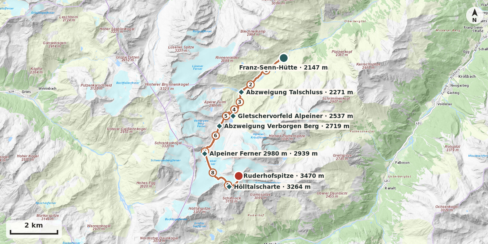
Route points: Franz-Senn-Hütte 0,0 km, 2150 m – Abzweigung Talschluss 2,5 km, 2270 m – Gletschervorfeld Alpeiner 4,3 km, 2540 m – Abzweigung Verborgen Berg 5,5 km, 2720 m – Alpeiner Ferner 2980 m 7,1 km, 2940 m – Hölltalscharte 9,1 km, 3260 m – Ruderhofspitze 9,9 km, 3470 m
At 3473 m, Ruderhofspitze is the highest summit of the Alpeiner Berge and the local mountain of the Franz-Senn-Hütte. As a summer alpine route it is above all long: it is more than eight kilometres across the broad Alpeiner Ferner to the Obere Hölltalscharte, followed at the end by a boulder ridge around 700 m long with easy climbing. Technically the normal route remains grade I, but in terms of stamina it is one of the most demanding routes in the hut area – and one of the finest.
Ascent: From the hut follow path no. 131 south-west along the Alpeiner Bach to the Höllenrachen (2192 m), then continue level through the valley floor. Climb on through stepped moraine terrain; at about 2520 m you reach a conspicuous level area, then go right onto the true left lateral moraine (c. 2625 m) and follow it over boulders and debris to its end. A final terrain step with glacially polished slabs, foot pegs and steel cables leads into the glacier basin; depending on the state of the glacier, step onto the Ferner at 2800 to 2950 m. Rope up here.
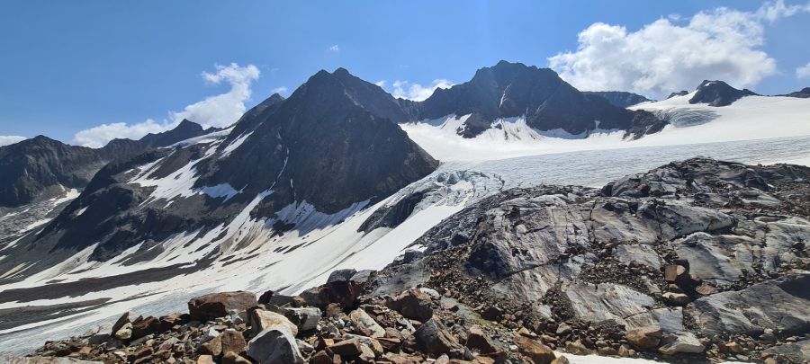
Make a wide detour round the large icefall on the right (west) and aim for the east spur of the Südliche Wildgratspitze. Then make a broad arc towards the south-south-east; again avoiding the upper icefall on the right, continue into the broad, relatively crevasse-free glacier basin below Ruderhofspitze and cross the flat firn to the Obere Hölltalscharte (c. 3250 m).
Summit: Two options. The normal route leads from the col along the long south-south-west ridge: first over boulder terrain, where ice often lies beneath the loose blocks near the col; the flanks are loose, so keep to the ridge crest. The ridge narrows and is exposed in places, then finishes with grade I climbing over the summit rise to the cross (about one hour from the col). Alternative from the glacier basin: climb through the west-south-west flank – a gully in the easternmost corner of the firn hollow, now usually ice-free and protected by fixed ropes – onto the firn field on the south side, cross this to the east shoulder and follow a short, moderately difficult east ridge to the summit.
Return: Descend as for the ascent via the Obere Hölltalscharte and the Alpeiner Ferner; put crampons on again from the col.
Notes: Around 1330 metres of ascent, 5 to 6 hours ascent, 4 hours descent. Full glacier equipment, ice axe, crampons, helmet, rope. Above the hut there is only meltwater – carry enough to drink. Start early. Best time July to September.
Descent: 4 hrs.
Photo credit: commons-ruderhofspitze-suedwest.jpg – Svickova, CC BY-SA 3.0, Wikimedia Commons, https://commons.wikimedia.org/wiki/File:Ruderhofspitze_S%C3%BCdwest.JPG
Photo credit: commons-ruderhofspitze-von-sueden.jpg – SchiDD, CC BY-SA 4.0, Wikimedia Commons, https://commons.wikimedia.org/wiki/File:Stubai-Schaufeljochblick-NO-Ruderhofspitze.jpg
Route description
-
Franz-Senn-Hütte → Abzweigung Talschluss
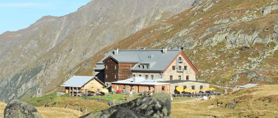
From the Franz-Senn-Hütte (2147 m), follow the marked path no. 131 towards the Alpeiner Ferner, heading up-valley along the Alpeiner Bach. For a good 2.5 km the route runs almost level across the valley floor; only at the Höllenrachen (c. 2190 m), where the stream squeezes through a short gorge, does the path overcome a small steep step (the via ferrata runs separately through the gorge).
-
Abzweigung Talschluss → Gletschervorfeld Alpeiner
From the signpost, follow the “Gletscherweg” up-valley as it climbs in switchbacks beside the waterfalls of the Alpeiner Bach to the glacier forefield of the Alpeiner Ferner (approx. 2520 m).
-
Gletschervorfeld Alpeiner → Abzweigung Verborgen Berg
From the signpost at the glacier forefield, follow the path up the slopes of the left lateral moraine to its crest. At the signpost there it meets the old approach path. Continue south along the moraine crest to the Verborgen Berg – Aperer Turm junction.
-
Abzweigung Verborgen Berg → Alpeiner Ferner 2980 m
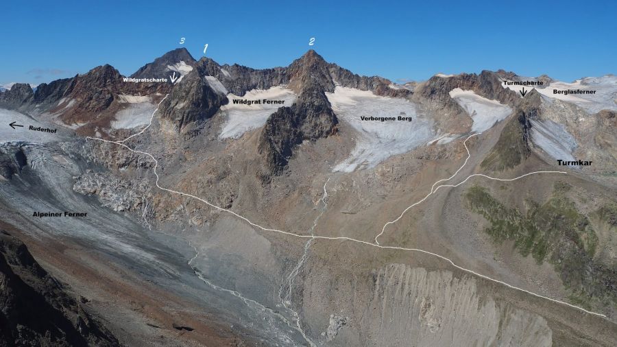
From the signpost, descend gently across the small glacial stream of the Verborgen Berg Ferner to the start of the lateral moraine of the Alpeiner Ferner. Continue on the marked path into a hollow below the Wildgratferner. From there, follow the waymarks and cairns over boulder field and glacially polished rock to just under 3000 m, where an unmarked junction leads to the Wildgratscharte / Ruderhofspitze.
-
to the Hölltalscharte
At the start of the broad glacier basin, make a wide arc south-southeast across the plateau. At 3100 m pass to the right of the upper icefall and continue without difficulty to the Obere Hölltalscharte, about 3250 m. The col alone is a worthwhile objective.
-
Hölltalscharte → Ruderhofspitze
In winter, leave skis at the ski depot at the col. Follow the narrow but straightforward south-west ridge on foot to the summit in about 1 h: first easy boulder ground, then along the ridge crest, which is usually well trodden and in places exposed. Easy climbing (I) at the start and in the summit wall. The last roughly 20 m are steep and rocky.