Ski tour · Winter
Östliche Seespitze via the Alpeiner Kräulferner 3416 m
- Duration
- 5 h
- Distance
- 7 km
- Ascent
- 1300 mDescent 30 m
- Highest point
- 3410 mfrom 2150 m
- Difficulty
- Ski ZSSAC ski touring scale (Gletschervorfeld Alpeiner Ferner – Östliche Seespitze)
- Start / finish
- Franz-Senn-HütteFinish: Östliche Seespitze
Equipment: Glacier equipment
Route points: Franz-Senn-Hütte 0,0 km, 2150 m – Abzweigung Berglasferner 2,5 km, 2270 m – Gletschervorfeld Alpeiner Ferner 3,5 km, 2530 m – Östliche Seespitze 6,8 km, 3410 m
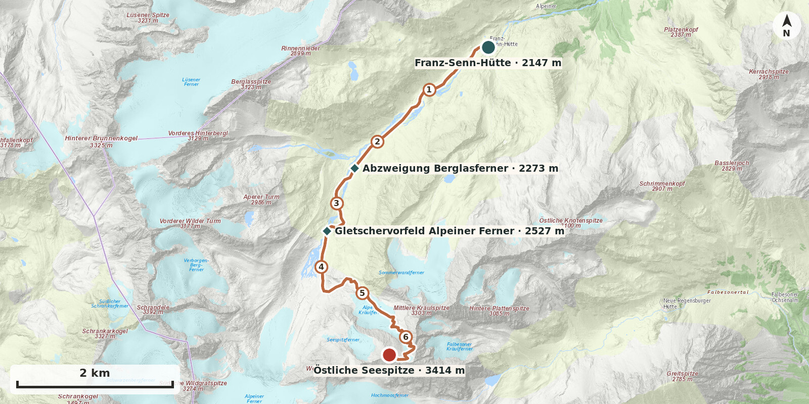
Östliche Seespitze is one of the finest high-level ski tours in the area of the Franz-Senn-Hütte: a long, uniformly steep glacier ascent and a descent of around 800 metres over the Alpeiner Kräulferner which, in safe powder snow, ranks among the best the Stubai Alps have to offer. The tour is demanding and requires glacier experience, secure kick-turn technique and, in hard conditions, crampons.
Route description
-
Franz-Senn-Hütte → Abzweigung Berglasferner
From the Franz-Senn-Hütte, follow the mostly groomed, pole-marked track to the head of the valley.
-
Abzweigung Berglasferner → Gletschervorfeld Alpeiner Ferner
From the head of the valley, climb on the right (facing uphill) over the moraine slopes to about 2400 m. Cross the Alpeiner Bach and make a broad right-hand arc up onto the glacier forefield of the Alpeiner Ferner.
-
Gletschervorfeld Alpeiner Ferner → Östliche Seespitze
From the rest area (prayer flags), follow the almost level ground southwards beneath two prominent gravel gullies to the true-right lateral moraines of the Alpeiner Ferner. Keep eastwards over the moraine and then through undulating terrain up to the tongue of the Alpeiner Kräulferner. On the glacier, follow its left edge (true right) through small hollows and moderately steep ground to below the steep flank. The Kräulferner has retreated considerably and is heavily crevassed, especially between 2800 and 3100 m. For this reason, move well out to the left in good time and climb the flank at its left edge. It becomes increasingly steep. At the top you reach a flat saddle below the Südliche Kräulspitze; from there continue to the ski depot below the summit ridge. On foot, cross a few rocks and finally follow a snow ridge to the summit.