Ski tour · Winter
Obere Kräulscharte via the Sommerwandferner 3150 m
- Duration
- 4 h
- Distance
- 5 km
- Ascent
- 1020 mDescent 20 m
- Highest point
- 3150 mfrom 2150 m
- Difficulty
- Ski ZSSAC ski touring scale (Schneemessstange – Obere Kräulscharte)
- Start / finish
- Franz-Senn-HütteFinish: Obere Kräulscharte
Route points: Franz-Senn-Hütte 0,0 km, 2150 m – Abzweigung Gschwezgrat 1,4 km, 2400 m – Schneemessstange 3,1 km, 2680 m – Obere Kräulscharte 5,2 km, 3150 m
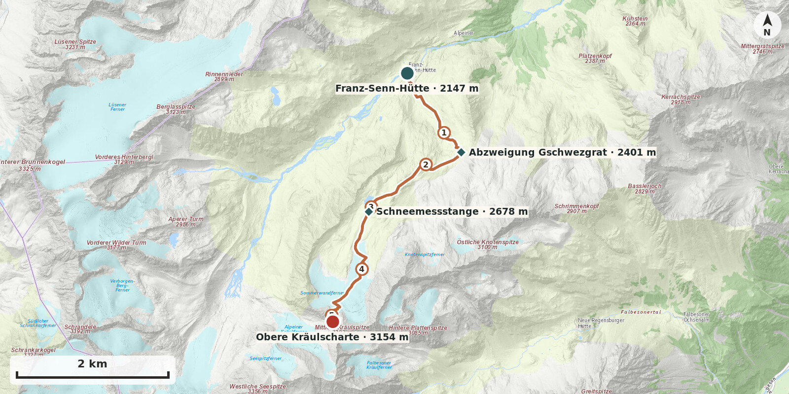
The Obere Kräulscharte is the quieter and slightly higher sister of the much-frequented Kräulscharte. It offers a glacier-dominated alpine day without climbing, with views from the eastern Seespitze across Schrankogel, Wildgratspitzen and Hinterbergl over to the Lüsener side, and back across the glacier basin towards the Oberbergtal.
Route description
-
Franz-Senn-Hütte → Abzweigung Gschwezgrat
From the hut, first follow the valley floor on level ground, then climb a short steep step and continue over easier ground southwards below the Gschwezgrat at about 2400 m.
-
Abzweigung Gschwezgrat → Schneemessstange
The path continues southwest, fairly level, into Stiergschwez. It then climbs briefly to the right to the upper Sommerwandsee (2500 m) and heads southwest again over a gentle ridge below the long Sommerwände. Cross knolls and hollows to reach the silted-up glacial lake. A conspicuous snow stake stands in this area.
-
Schneemessstange → Obere Kräulscharte
From the snow stake, head south over level ground towards the glacier lobe on the left (facing uphill). A well-laid track climbs at a uniformly steep angle to 3000 m, directly below the Obere Kräulscharte. From here the terrain becomes increasingly steep and the track climbs in switchbacks to the col.