Hike · Summer
Basslerin 2830 m (Basslerjoch)
- Duration
- 2 h 40 min
- Distance
- 6.5 km
- Ascent
- 760 mDescent 80 m
- Highest point
- 2830 mfrom 2150 m
- Difficulty
- Trail T2SAC hiking scale (Franz-Senn-Hütte – Schrimmennieder)
- Start / finish
- Franz-Senn-HütteFinish: Basslerjoch
Route points: Franz-Senn-Hütte 0,0 km, 2150 m – Schrimmennieder 6,2 km, 2710 m – Basslerjoch 6,7 km, 2830 m
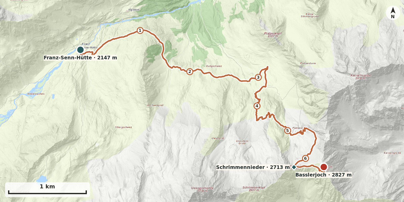
The Basslerjoch, known locally as the Basslerin, is the viewpoint above the Franz-Senn-Hütte on the ridge between the Oberbergtal and the Falbesoner Tal. The inconspicuous ridge above the Schrimmennieder gives one of the finest views in the Stubaital: the glaciated chain of the main ridge from the Zuckerhütl to the Wilder Freiger, and down-valley to the Habicht and the Serles. The route follows the Stubaier Höhenweg (path no. 133) and is a moderately difficult mountain walk.
Ascent: Behind the hut, take path no. 133 eastwards for about 200 metres below the slopes of the Gschwezgrat to the Gschwezbach. Beyond the stream the path contours in a wide arc around the Gschwezgrat into the Kuhgschwez, gaining almost no height. After the first switchback, climb southwards into the “Unnutze Grübl”. Just above 2450 m the path crosses a ridge and leads into the Platzengrube. Steep switchbacks and a long traverse to the right lead to the Schrimmennieder (2706 m), the crossing to the Neue Regensburger Hütte. From the Nieder it is about 20 minutes over the broad ridge to the summit (2830 m).
Return: Return to the hut by the same route. As a traverse, the Basslerin can be included in the stage of the Stubaier Höhenweg: from the Schrimmennieder descend in numerous switchbacks to the crossing path, then follow it almost level to the Neue Regensburger Hütte.
Route description
-
Franz-Senn-Hütte → Schrimmennieder
Behind the hut, trail no. 133 leads east for about 200 metres below the slopes of Gschwezgrat to Gschwezbach. Beyond the stream, the path runs almost without gaining height in a wide arc around Gschwezgrat into Kuhgschwez. After the first switchback, continue south up into “Unnutze Grübl”. Just above 2450 m, the path crosses a ridge and leads into Platzengrube. Steep switchbacks and a long traverse to the right lead to the Schrimmennieder, 2706 m, the crossing to the Neue Regensburger Hütte.
-
Schrimmennieder → Basslerjoch
From the Schrimmennieder, follow the path right over the broad west ridge into the south flank of the summit block; it then climbs slightly more steeply to the summit cross of Basslerjoch at 2829 m.