Hike · Summer
The Rinnennieder 2900 m
- Duration
- 3 h
- Distance
- 4 km
- Ascent
- 760 mDescent 10 m
- Highest point
- 2900 mfrom 2150 m
- Difficulty
- Trail T3SAC hiking scale (Franz-Senn-Hütte – Abzweigung Höhenweg)
- Start / finish
- Franz-Senn-HütteFinish: Rinnennieder
Route points: Franz-Senn-Hütte 0,0 km, 2150 m – Abzweigung Höhenweg 0,5 km, 2200 m – Abzweigung Rinnensee Rinnenspitze 2,6 km, 2620 m – Rinnensee 2,8 km, 2650 m – Rinnennieder 3,8 km, 2900 m
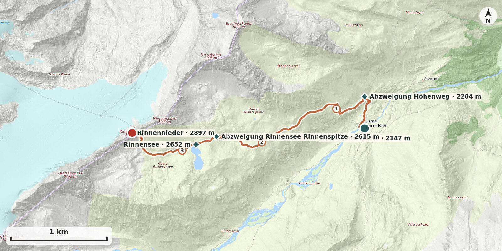
The Rinnennieder, a small col at just under 2900 m beside Rinnenspitze and west above the Rinnensee, is the crossing from the Oberbergtal to the Lüsener Ferner. For walkers it is a quiet, worthwhile objective: from the saddle the view opens out suddenly onto the broad, white Lüsener Ferner and Lüsener Fernerkogel. The path is straightforward as far as the lake; the final climb leads through a boulder field and requires sure-footedness.
Route description
-
Franz-Senn-Hütte → Abzweigung Höhenweg
Behind the hut, cross the bridge over the Alpeiner Bach and immediately turn right onto the marked path towards the Starkenburger Hütte. After about 10 minutes you reach the junction.
-
Abzweigung Höhenweg → Abzweigung Rinnensee Rinnenspitze
From the junction, climb at first quite steeply through the grassy slopes above the hut, then more gently across the sunny, grass-covered south side, steadily gaining height. Higher up the path becomes stonier and crosses a boulder field, but remains well constructed. After about 1 to 1½ hours you reach the junction for Rinnenspitze on the right at around 2600 m.
-
Abzweigung Rinnensee Rinnenspitze → Rinnensee
From the turn-off for Rinnenspitze, reach the north shore of the Rinnensee in 10 minutes.
-
Rinnensee – Rinnennieder
Follow the path past the Rinnensee through a boulder field below the Rinnennieder. Climb in switchbacks to the col.